

IITM-ESM Climate Viewer
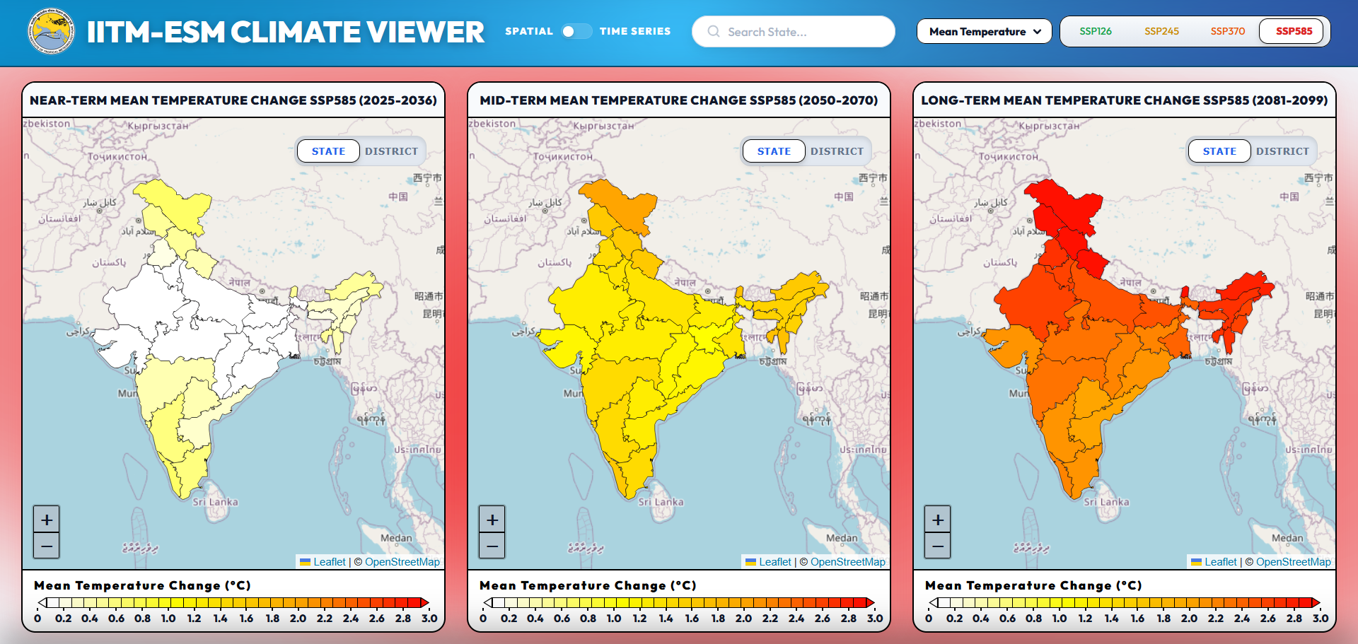
Explore our interactive climate viewer showcasing high-resolution climate simulations from the IITM Earth System Model (IITM-ESM). Dive into regional climate patterns and future projections.
Atmosphere and Land Components
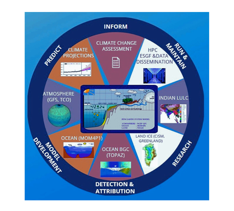
The atmospheric component of IITM-ESMv1 is based on the NCEP GFS model and has a spectral triangular truncation of 126 waves (T126) in the horizontal (∼0.9° grid) and finite differencing in the vertical with 64 sigma-pressure hybrid layers. It employs the simplified Arakawa–Schubert convection scheme, with cumulus momentum mixing. The land surface model (LSM) is the Noah LSM, with four layers (Ek et al. 2003), as in CFSv2. Further details can be found in Saha et al. (2010).
Ocean BGC
The ocean biogeochemistry (BGC) component of IITM-ESM, integrated within MOM4p1, offers improved physics and includes the TOPAZ model. TOPAZ is a comprehensive model for oceanic ecosystems, considering 22 tracers, including phytoplankton groups, dissolved organic matter, and inorganic species for C, N, P, Si, Fe, CaCO3, and O2 cycling. It incorporates processes like gas exchange, atmospheric deposition, and denitrification. Phytoplankton groups undergo co-limitation by light, N, P, and Fe with flexible physiology. Particle export is described through size and temperature-based detritus formation. The model is compatible with both MOM4p1 and GFDL’s isopycnal model GOLD.
Ocean: MOM4p1 (grid: 360x300x50L)
The ocean component of IITM-ESM uses Modular Ocean Model version 4.1 (MOM4p1). To circumvent the singularities at the poles, it utilizes a tripolar grid. The model has a zonal resolution of 1 degree (360 grid points), while the meridional resolution (300 grid points) varies from a nominal resolution of 0.3 degrees near the equator and gradually coarsens to 1 degrees near the poles . The vertical coordinates are z* with 50 levels.
- Sea Ice: SIS
- Ocean Biogeochemistry: TOPAZ
Land NOAH
- Glaciers: CISM
- Rivers: River discharge from river basins to river destination points
Coupler : FMS
Flexible Modelling System (FMS) developed by GFDL, which manages surface flux exchange, I/O, timestep synchronization and grid interpolation across ESM components using an exchange grid.
Atmosphere
We produce high-resolution climate simulations using the atmospheric component of the IITM Earth System Model (IITM-ESM) for global and regional applications and CORDEX-compliant regional climate models for South Asia.
Land Use and Land Cover Change (LULCC) and Climate Interactions
We examine the impacts of land use and land cover change on regional climate, hydrology, and ecosystem dynamics. We study the impacts of deforestation, urbanization, and agricultural shifts, and their feedbacks on the monsoon system, carbon cycle, and surface energy balance using the IITM Earth System Model.