Centre for Climate Change Research
Indian Institute of Tropical Meteorology, Pune, India
Latest Updates
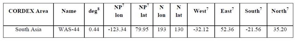
- Definition of CORDEX equidistant longitude / latitude rotated grids with the position of the rotated North Pole given in geographic coordinates in columns 4 and 5. The rotated zero longitude is defined as going through the geographic North Pole. The number of cells is Nlon by Nlat. The last 4 columns define centers of the outermost cells of the rectangular area in rotated coordinates. Columns 3 gives the grid spacing in rotated coordinates. For more details please click here
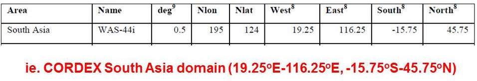
- Table No. 1
- Regular geographic grids corresponding to the CORDEX are as of Table 1. For the additional delivery of Core variables.
- Table No. 2